PAOC Spotlights
Houghton Lecturer Late Fall 2010 - Lance Bosart, SUNY
The Houghton Lecturer for Late Fall 2010 was Lance Bosart (University of Albany, NY) (visit dates Nov 8th - Nov 19th).
 Prof. Bosart's area of interest is broad including planetary-scale, synoptic-scale and mesoscale meteorology. Bosart works on a variety of multiscale (time and space) research problems that relate to the weather and climate of higher- and middle-latitude regions as well as the tropics. He finds research problems that involve winter storms, hurricanes, organized convective systems and the predictability of individual flow regimes especially attractive. He is also interested in the weather analysis and forecasting process, including forecast verification studies and the measurement and assessment of forecaster skill. Lance is an alumni of the MIT Meteorology Program (1969).
Professor Bosart gave two lectures during his visit as well as leading map discussions of current weather events with emphasis on interpretation and use of the dynamic tropopause maps.
Lecture 1:
Upper-level Potential Vorticity Disturbances as a Source of Severe Weather during the Southwest Summer "Monsoon"
During the North American summer monsoon (NAM) the Southwest U.S. frequently experiences damaging severe weather and disruptive flash flood events in conjunction with mesoscale convective systems (MCSs) that typically form over higher terrain in the afternoon and early evening in response to the diurnal heating cycle. MCSs that propagate westward and southwestward off the higher terrain of Arizona can become severe as they approach the Phoenix and Tucson metropolitan areas, especially if they encounter a moist flow of tropical moisture from the Gulf of California (GC). Transient upper-level subsynoptic-scale potential vorticity (PV) disturbances (PVDs) that approach Arizona from the east can enhance deep northeasterly shear and contribute to the organization of severe weather-producing MCSs that form over the Mogollon Rim and the elevated terrain off southeastern Arizona and then propagate toward the populous regions of southern Arizona. The study also prompts questions about whether the NAM is a true monsoon system.
Lecture 2:
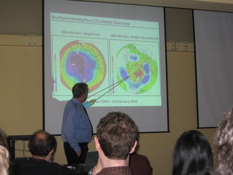
Extreme Weather Events over Parts of the Northern Hemisphere during Winter 2009-2010
The large-scale circulation over the Northern Hemisphere (NH) during winter 2009-2010 was dominated by a strongly negative (3-5 standardized anomalies) Arctic Oscillation (AO). Blocking that began over the North Pacific in early December in conjunction with "ridge-building" ahead of recurving and transitioning tropical cyclones over the western North Pacific culminated in the formation of a strong high-latitude ridge over Alaska. High-latitude blocking subsequently expanded to the North Atlantic where it continued intermittently into February. The winter of 2009-2010 was noteworthy for extreme weather over North America (storminess over the southern U.S., epic snowstorms in parts of the eastern U.S, damaging cold in Florida), western Europe (persistent snow cover and cold weather), and eastern Asia (extreme cold) that occurred in conjunction with the strongly negative AO teleconnection pattern, the associated high-latitude blocking events, and a moderate El Nino event. The purpose of this presentation will be to examine how intraseasonal variaibility arising from the strongly negative AO pattern and associated persistent high-latitude blocking contributed to episodic extreme weather events that helped to determine the location, sign, and magnitude of the seasonal temperature and precipitation anomaly patterns during winter 2009-2010. The winter of 2009-2010 over the NH is a textbook example of how tropical and midlatitude flow interactions govern intraseasonal variability.